Examples and workflows
Choose a path that matches the evidence you have. The first path is fully offline; the other two require reviewed source inputs or an existing release.
| Path | Start here | Result and limit |
|---|---|---|
| 1. Offline first result | Quick start and demo details | Synthetic bathymetry Parquet, manifest, report, figures; validates a small transform, not a region. |
| 2. Bounded real-data candidate | Preparation and processing, configuration, San Juan pilot | A candidate based on reviewed local inputs; preflight and exploratory pilot results are not blanket release approval. |
| 3. Existing audited release | Freeze and read a release, metric matrix | Exact release/product/resolution artifact and optional H3 export, with source nulls and QC preserved. |
The validation notebook is an optional readable client of the offline demo. It calls production APIs and is separate from the San Juan live explorer, which has explicit acquisition and exploratory support. Examples requiring real inventories intentionally use configured paths and source review rather than pretending a public dataset is bundled.
Bounded San Juan illustration
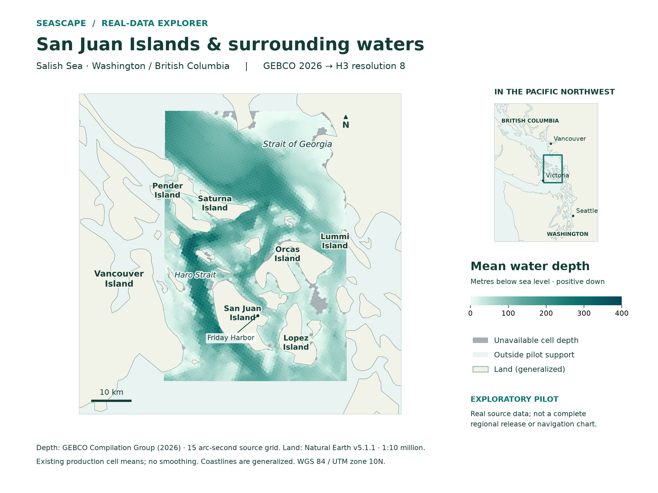
The San Juan pilot documents two bounded, cached-input bathymetry/support runs and their acceptance limits. The map is geographic context for that family result; it is not produced by the synthetic quick start. See map sources and reproduction for attribution and rendering details.